
Open Source GPS Hardware / Software Solution

The hardware is a masterpiece of simplicity and contains smallest microcontrollers Atmel microcontrollers (ATTiny2313) and all in one GSM/GPS module (SIM548C/SIM908C).
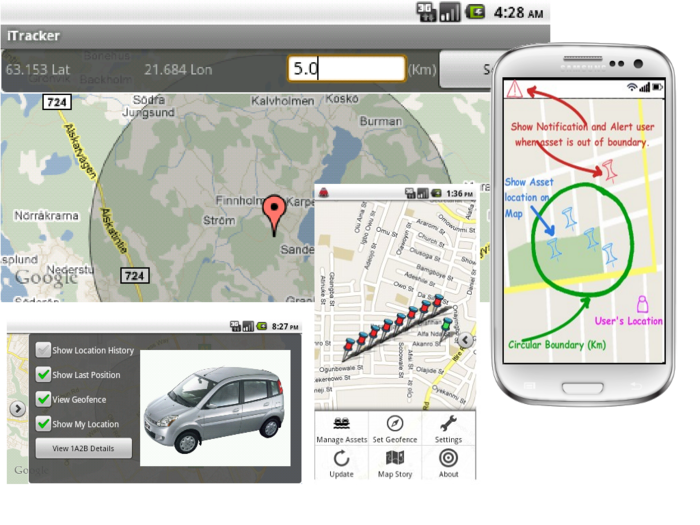
Apart from vehicles you can also track, pets or people like hikers. This application uses a very small footprint. Both external and internal antennae are being supported by the tracker. For instance, a car application an external antenna with long leads is required for maximum placement flexibility.

Once the tracker is placed it can be used on any supported platform to track your assets. All major operating systems are supported like Windows, MacOS, Linux, Free BSD and an Android version

Features
- Easily add assets and asset categories for a clear overview of your data
- Configure the remote tracker's password and reporting phone number
- Create and manage geofences and get per asset alert messages when outside geofence
- Switch tracker update intervals (timely updates), request update at any time, or put the tracker in 'tracking' mode whereby updates are sent based on change in speed and heading
- View logs of the asset with all the information regarding battery, tracking history, etc.
- Export tracking data as GPX to easily use in other applications such as Google Earth
- Configure the use of either the GSM modem or Clickatell to send commands to the tracker. This means that even if you can only receive SMS with your modem (e.g., low prepaid credit), you can still send commands to your tracker cheaply with Clickatell.
- Support for both Metric and Imperial units
As with any upcoming start-up the capital and funds are limited, and they need your support.
You can also go ahead and support this great project and help the innovation drive.
You can also go ahead and support this great project and help the innovation drive.


 TechQuark is a mobile-friendly website. Simply bookmark